| ArchaeoBlog |
|
2025.03.14 - Amazon Geoglyphs have been keeping me busy, so much so this year I am finally updating the ArchaeoBlog for the first time in mid-March. Nonetheless, as is my routine, these two files were updated for the new year and have since been updated several times:
The improvement in satellite imagery resolution along with image timing correlated to seasonally optimal vegetation contrast revealed some difficult to discern raised earthworks (embankments/terraplens, geoglyphs without zanjas/ditches) and additional pathway berms connected to them. Several of these previously undetected geoglyphs are among the largest recorded. I have updated the online geoglyphs database and KML file a few times since last summer and the current amazon_results.kml is a v2025.02 update. Due to margin of error concerns in older satellite imagery placements I hesitate to share some study results. Recent high resolution updates reduced some incertitude, albeit uncertainty in quantifying margin of error remains. The exigency of geoglyph destruction outweighing that concern factored into my decisions regarding which results to include.
Some large geoglyphs I discovered last summer are already plowed in the first satellite images showing them. The embankment/terraplen constructs are partucularly vulnerable to any mechanized activity. Recent resurveys reveal that some geoglyphs I reported to authorities in Brazil as damaged have since been replowed or bulldozed after I reported them. Acre Circle, the largest true circle, and Acre Octagon have both been replowed. Madiera Square is now totally bulldozed, leveled to grow soybeans. The destruction list is long and continues to grow. Both discovery of more immense embankment sites and new findings revealing their importance heighten conservation concerns. I was very appreciative when attention was drawn to geoglyph destruction by some exceptional recent reporting.
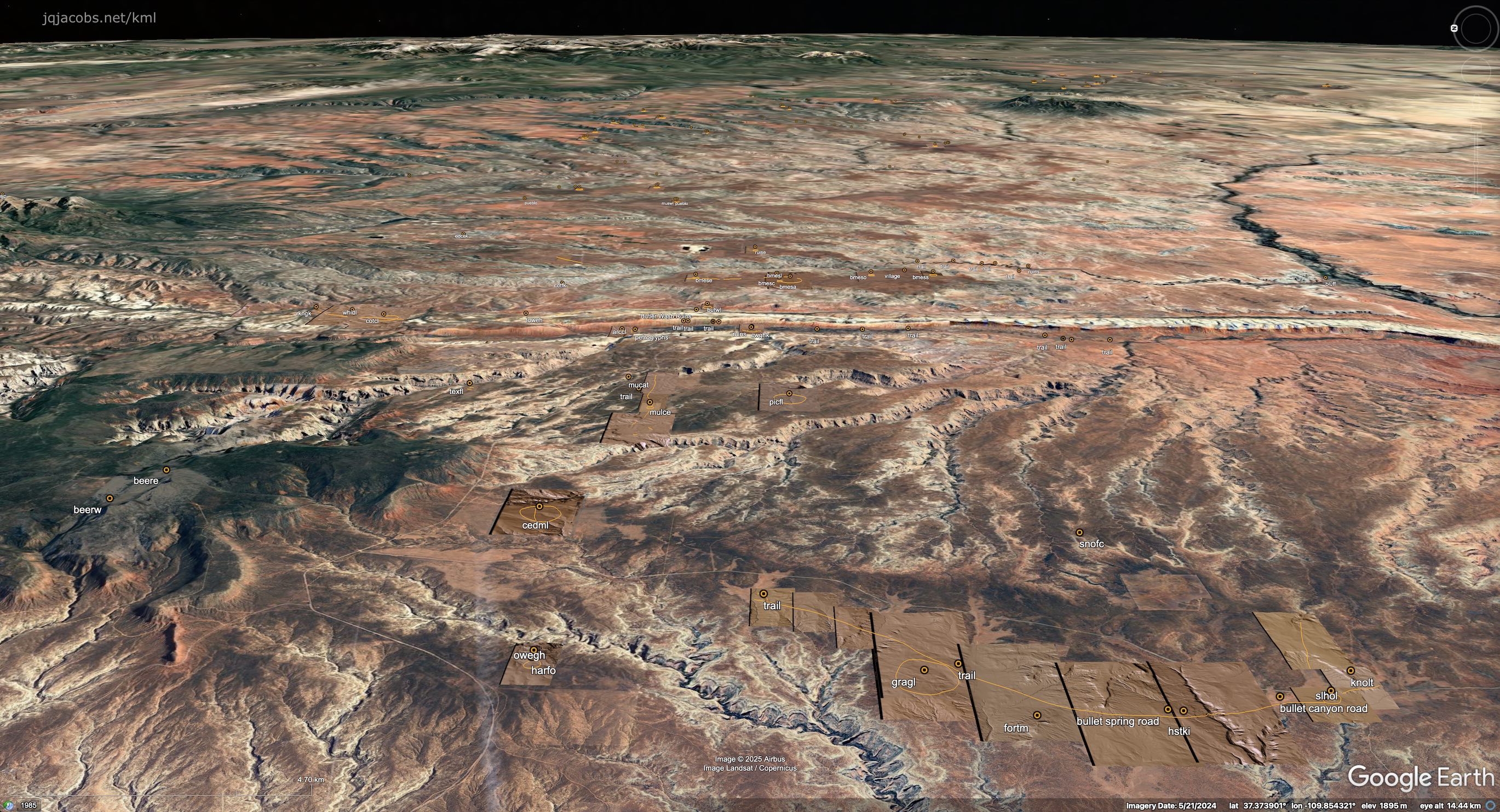
2025.10.18 - After catching up with Amazonia surveys a month ago, now over 1,500 geoglyphs placemarked, and updating online files my attention shifted to North America. Large circular monuments in the Northern San Juan region, the Four Corners area of the American Southwest, are visible using online lidar viewers. These circular earthworks came to my attention via an article in American Archaeology a decade ago featuring Holmes Group lidar produced by Richard Friedman. The earthworks are often termed loop roads. I consider "road" interpretative implying a function, so to avoid naming with interpretations I simply call them loops. I considered using geoglyphs, but prefer a distinct classification. I documented several large loops a few years ago and results of their site-to-site relationships motivated finding and placemarking more loops. I'm using several lidar viewers with different amounts of contrast to display USGS 3D Elevation Program (3DEP) data based on one meter resolution digital elevation modeling, quite a contrast to survey of satellite imagery for Amazonia. I colorize the lidar to better match the landscape and place the lidar imagery in Google Earth as overlay images. Lidar enhances displaying topography of the flat looking satellite imagery. Tilting and rotating the imagery enhances understanding monument placement in the larger landscape and reveals the viewshed of the monuments. So far I've recorded over forty loops in my area of survey coverage, spanning from Grand Gulch on Cedar Mesa to Mesa Verde. To my surprise, I found several loops are even larger than I expected or realized existed, up to 1,200 meters wide. After finding a 1,000 meter wide loop, I also began researching the archaeology literature and found they are known to specialists in the region. My surprise of the discovery was nonetheless undiminished. In the 1980s I spent a lot of time in the area recording rock art and had passed near the loops often, driving across one many times and likely even walking across the largest one. I expected site-to-site results to be interesting, but even I was surprised once again. The Southwest Loops KML placemarks include 68 lidar overlays, 46 loop outlines, 45 site placemarks, selected study results, and a readings list. I may add more data as research continues, but I wanted to post a study update for International Archaeology Day.
|


 Previous Years Linked Below |

