| Serpent Mound State Memorial, a Photo Gallery |
 |
The serpent has a coiled tail at the upper end and open maws at the lower end, as if about to swallow the oval mound. The oval mound has variously been interpreted as a egg and the sun about to be swallowed by an eclipse. The mound points in the direction of summer solstice sunset. |
There are several interpretation signs. Click images for larger views. Serpent Mound
Placemark File. Ancient Monuments
Placemarks |
|


 |
Archaeologists in 1991 opened a trench first cut by the Putnam excavaton in the late 1800s and recovered organic materials from the undisturbed edge of the trench. Radiocarbon dating placed construction at about 900 years ago, over a millenia later than once thought based on association with the nearby Adena burial mounds (image below). Next below is the tail of the serpent with the GPS receiver along the west edge. |
 Serpent
Mound sits within an oblong crater where a massive extraterrestrial
object collided with the earth.
The crater overlaps Adams, Pike and Highland counties, and the mound
is near the
five-mile-across crater's southwest
edge.
The topography around Serpent
Mound is jumbled, and impact theory explains why for many geologists.
Boreholes samples show microscopic cracks in quartz crystals and horsetail-shaped
fracture shatter cones, patterns resembling nuclear reactions. Iridium
is high in the area.
Serpent
Mound sits within an oblong crater where a massive extraterrestrial
object collided with the earth.
The crater overlaps Adams, Pike and Highland counties, and the mound
is near the
five-mile-across crater's southwest
edge.
The topography around Serpent
Mound is jumbled, and impact theory explains why for many geologists.
Boreholes samples show microscopic cracks in quartz crystals and horsetail-shaped
fracture shatter cones, patterns resembling nuclear reactions. Iridium
is high in the area.
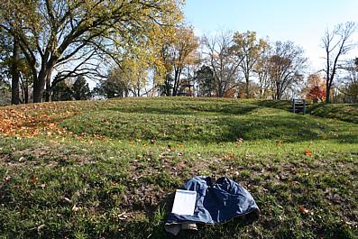
One of the burial mounds near Serpent Mound.
|
|

|
||||||||||||||||
