Ancient Monuments in Google Earth
Spanning the globe, more than 15,000 placemarks of ancient monuments and anthropogenic features visible in satellite imagery, includes most of the 8,000+ monuments with coordinates in my Excel applet. The current version no longer embeds the 5,000 Panoramio photos I selected for archaeological value. Open the files in Google Earth and click the placemarks to display informational balloons and zoom in on sites.
Download - 9.4 MB Google Earth file: archaeogeodesy.kml

Andes Archaeogeodesy Articles and KML Files
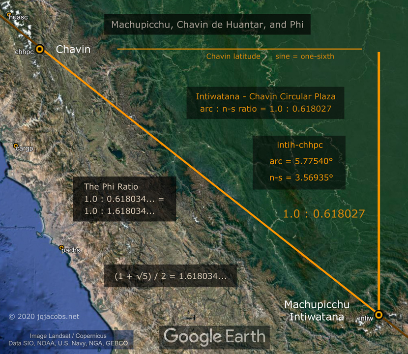
2021-01-20 — Machupicchu Archaeogeodesy — machupicchu.kml
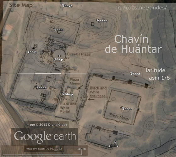
2018-10-20 — Chavin de Huantar Archaeogeodesy — chavin.kml
2017-10-21 — Casma-Sechin Archaeogeodesy — sechin.kml
Hundreds of Geoglyphs Discovered in the Amazon

KML placemarks file with 1,300 geoglyphs in Brazil and Bolivia.

Space Archaeology in the Amazon, Beni, Bolivia - 2.7 MB KML file.

Google Earth placemarks file: jqjacobs.net/andes/machu_picchu_phi.kml

jqjacobs.net/andes/sol.kmz
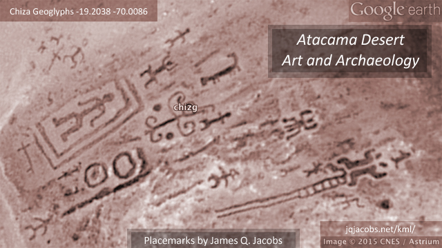
Atacama Desert Art and Archaeology - placemarks of geoglyphs and more - atacama.kml
Ancient Monument Placemarks |